
HawkEye 360 Pinpoints Hard‑to‑Locate Transmitter, Restoring Spectrum Availability for NOAA's GOES Weather System
HawkEye 360 (NYSE: HAWK) reported it successfully geolocated an environmental data transmitter that had been occupying a valuable uplink position on NOAA's GOES Data Collection System for several years.
Rhea-AI Summary
HawkEye 360 (NYSE: HAWK) reported it successfully geolocated an environmental data transmitter that had been occupying a valuable uplink position on NOAA's GOES Data Collection System for several years. The transmitter’s physical location had been unknown, preventing reassignment of the GOES uplink slot to other authorized users.
Using space-based RF data and analytics, HawkEye 360 provided NOAA with a precise location, allowing the operator to verify and remove the device, restoring full spectrum availability and regulatory compliance. The insight also enabled the operator to find a second transmitter and recover multiple non-functioning devices. The company highlighted this mission as part of a growing record of support to NOAA, including prior geolocation operations that resolved GOES interference across dozens of countries.
Positive
- None.
Negative
- None.
News Explained
The completed mission restored an uplink position used by more than 600 organizations in 42 countries after NOAA verified and removed the transmitter, establishing the operational reach of the fix.
Details
Market reaction after NOAA transmitter geolocation: HAWK -6.08% in the Jul 29 session
In the Jul 29 session, HAWK declined 6.08%, reflecting a notable negative market reaction. Argus tracked a peak move of +7.8% during that session. Argus tracked a trough of -2.7% from its starting point during tracking. Our momentum scanner triggered 24 alerts that day, indicating elevated trading interest and price volatility.
Data tracked by StockTitan Argus on the day of publication.
Key Figures
- Organizations served
- more than 600 organizations
- GOES Data Collection System uplink
- Countries served
- 42 countries
- Organizations using the GOES uplink position
- Transmission duration
- 1.9 seconds
- Transmitter operating interval
- Channel width
- 1.5 kHz
- Transmitter channel
- Prior mission reach
- more than 50 countries
- Earlier UHF uplink interference mission
Historical Context
-
Indian Navy contract expanded daily RF collection and geolocation services in the Indo-Pacific.
-
Valiant Shield participation demonstrated commercial RF integration with Lockheed Martin defense systems.
-
Smithsonian exhibit featured the Pathfinder satellite and commercial signals-intelligence technology.
-
Record revenue and adjusted EBITDA coincided with a reported quarterly net loss.
-
New leaders were appointed for the HawkEye–ISA signal-analysis unit.
24h Move is the share-price change in the day after each event; other market factors may also have contributed.
Key Terms
signals intelligence technical
geolocation technical
uplink technical
AI-generated analysis. How Rhea-AI works. Not financial advice.




"This mission demonstrates how our space-based signals intelligence can directly support the continuity of essential civil systems," said Todd Probert, Chief Operating Officer at HawkEye 360. "Working with NOAA, we were able to pinpoint a transmitter that had been missing for years and return valuable spectrum to the organizations that depend on it for environmental monitoring and public safety."
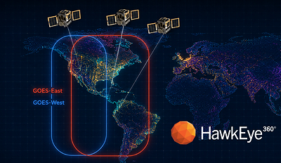
Although the transmitter continued to broadcast, its exact location was unknown, which meant the uplink slot could not be reassigned for other authorized users. NOAA partnered with HawkEye 360 to better understand the signal activity and determine the transmitter's position using space-based RF data and analytics.
The device's characteristics made it extremely difficult to isolate, transmitting for only 1.9 seconds at a time and using a narrow 1.5 kHz channel. The emitter operated among multiple simultaneous uplinks. HawkEye 360 provided NOAA with a precise geolocation, enabling the operator to verify the equipment and remove it. The action restored full availability of the uplink slot and returned the operator to compliance with federal regulations.
Importantly, pinpointing the source gave the operator enough insight to locate a second transmitter on their own. This led to the recovery of multiple non-functioning devices that had gone undetected for years and can now be refurbished and repurposed to support future environmental monitoring needs. The mission not only resolved an active interference issue but also strengthened the operator's ability to maintain and optimize their broader sensor network.
Building on a Growing Record of Support to NOAA
This latest mission adds to HawkEye 360's expanding portfolio of successful operations supporting NOAA's efforts to safeguard the GOES DCS from harmful interference. Previous missions include:
- Identifying and helping resolve a persistent UHF uplink interferer impacting environmental data delivery across more than 50 countries.
- Geolocating a disruptive transmitter near
Quito, Ecuador , enablingEcuador's telecommunications authority to remove an outdated device located on the slopes of Guagua Pichincha volcano.
Together, these missions underscore the growing importance of space-based RF intelligence in preserving the reliability of civil, non‑military systems such as the GOES Weather System, which supports real-time volcanic monitoring, flood forecasting, tsunami alerts, and thousands of environmental sensors worldwide.
About HawkEye 360
HawkEye 360 is equipping defense, intelligence, and national security leaders with mission-critical signal intelligence to enable faster, better decision-making. By detecting, geolocating, and characterizing radio-frequency emissions worldwide, HawkEye 360 delivers trusted domain awareness and early-warning indicators to the U.S. Government and allied partners. Our space-based collection, proprietary signal processing, and AI-powered analytics transform knowledge of the RF spectrum into a strategic advantage. Proven by operational mission success, HawkEye 360 is redefining how signals intelligence strengthens national and global security.
Forward-Looking Statements
This press release includes forward-looking statements within the meaning of the "safe harbor" provisions of the Private Securities Litigation Reform Act of 1995. All statements contained in this press release other than statements of historical fact, including statements regarding the availability and capabilities of the Company's products, are forward-looking statements and represent the Company's views as of the date of this press release. The words "will," "expects," "plans," "could," "would," "believes," "anticipates," "intends," "may," "continue," "estimate," or similar expressions are intended to identify forward-looking statements. The Company has based these forward-looking statements on its current expectations and projections about future events and financial trends that the Company believes may affect its financial condition, results of operations, business strategy, short-term and long-term business operations and objectives and financial needs. These forward-looking statements are subject to a number of assumptions and risks and uncertainties, many of which involve factors or circumstances that are beyond the Company's control that could affect its financial results. These risks and uncertainties are detailed in the sections titled "Risk Factors" and "Management's Discussion and Analysis of Financial Condition and Results of Operations" in the Company's quarterly report on Form 10-Q dated June 22, 2026, and other filings that the Company makes from time to time with the SEC, which are available on the SEC's website at sec.gov. Moreover, the Company operates in a very competitive and rapidly changing environment. New risks emerge from time to time. It is not possible for management to predict all risks, nor can the Company assess the impact of all factors on its business or the extent to which any factor, or combination of factors, may cause actual results to differ materially from those contained in any forward-looking statements the Company may make. In light of these risks, uncertainties and assumptions, the future events and trends discussed in this press release may not occur and actual results could differ materially and adversely from those anticipated or implied in any forward-looking statements. Except as required by law, the Company is under no obligation to update these forward-looking statements subsequent to the date of this press release, or to update the reasons if actual results differ materially from those anticipated in the forward-looking statements.

 View original content to download multimedia:https://www.prnewswire.com/news-releases/hawkeye-360-pinpoints-hardtolocate-transmitter-restoring-spectrum-availability-for-noaas-goes-weather-system-302837476.html
SOURCE HawkEye 360 Inc.
FAQ
AI-generated questions and answers. How Rhea-AI works. Not financial advice.