
Guardian Exploration Completes High-Resolution Airborne Geophysical Survey at Mount Cameron Project, Yukon
Rhea-AI Summary
Guardian Exploration (OTCQB: GXUSF) has completed a high-resolution airborne magnetic and radiometric survey over its 100%-owned Mount Cameron silver-lead-zinc project in the Mayo Mining District, Yukon. The helicopter-borne survey by Precision GeoSurveys covered approximately 669 line-kilometres over a 30.3 km² block.
The program, flown at 50 m line spacing and 40 m nominal height using a cesium-vapour magnetometer and 21-litre NaI(Tl) spectrometer, is designed to map structural features, alteration zones and geological contacts. According to Guardian Exploration, integrating these data with existing geological, geochemical and LiDAR datasets will help prioritize drill targets, with final processed products expected in the coming weeks.
Positive
- None.
Negative
- None.
AI-generated analysis. How Rhea-AI works. Not financial advice.




Calgary, Alberta--(Newsfile Corp. - July 16, 2026) - Guardian Exploration Inc. (TSXV: GX) (OTCQB: GXUSF) (FSE: R6B) ("Guardian" or the "Company") is pleased to announce the successful completion of a high-resolution airborne magnetic and radiometric survey over its
Highlights
High-resolution airborne magnetic and radiometric survey completed across the Mount Cameron Project.
Survey designed to identify structural features, alteration zones and geological contacts that may control high-grade silver-lead-zinc mineralization.
Final processed geophysical products will be integrated with existing geological, geochemical and LiDAR datasets.
Processed geophysical interpretations will assist in prioritizing drill targets for the Company's ongoing exploration program.
The survey was completed by Precision GeoSurveys Inc. ("Precision") of Langley, British Columbia, using a helicopter-borne geophysical platform designed to acquire magnetic and radiometric data across the Project area. The survey totalled approximately 669 line-kilometres over a 30.3 km² block, flown on 108°/288° survey lines at 50 m spacing (tie lines at 500 m) and a nominal flight height of 40 m above ground, using a cesium-vapour magnetometer and a 21-litre NaI(Tl) gamma-ray spectrometer. The survey is expected to enhance the Company's understanding of the geological setting, distribution of lithological units, and structural controls associated with mineralization at Mount Cameron.
Graydon Kowal, President & Chief Executive Officer of Guardian Exploration, commented: "The completion of this airborne survey marks another significant step forward for Mount Cameron. Modern airborne geophysics will provide an important new layer of processed geological information that will complement our existing geological, geochemical and LiDAR datasets. Integration of the magnetic and radiometric geophysical data will significantly enhance our understanding of the Project and help prioritize high-quality drill targets for the next phase of exploration at Mount Cameron."
Preliminary datasets received from the survey confirm complete coverage of the planned survey block and include both Total Magnetic Intensity ("TMI") and radiometric measurements.
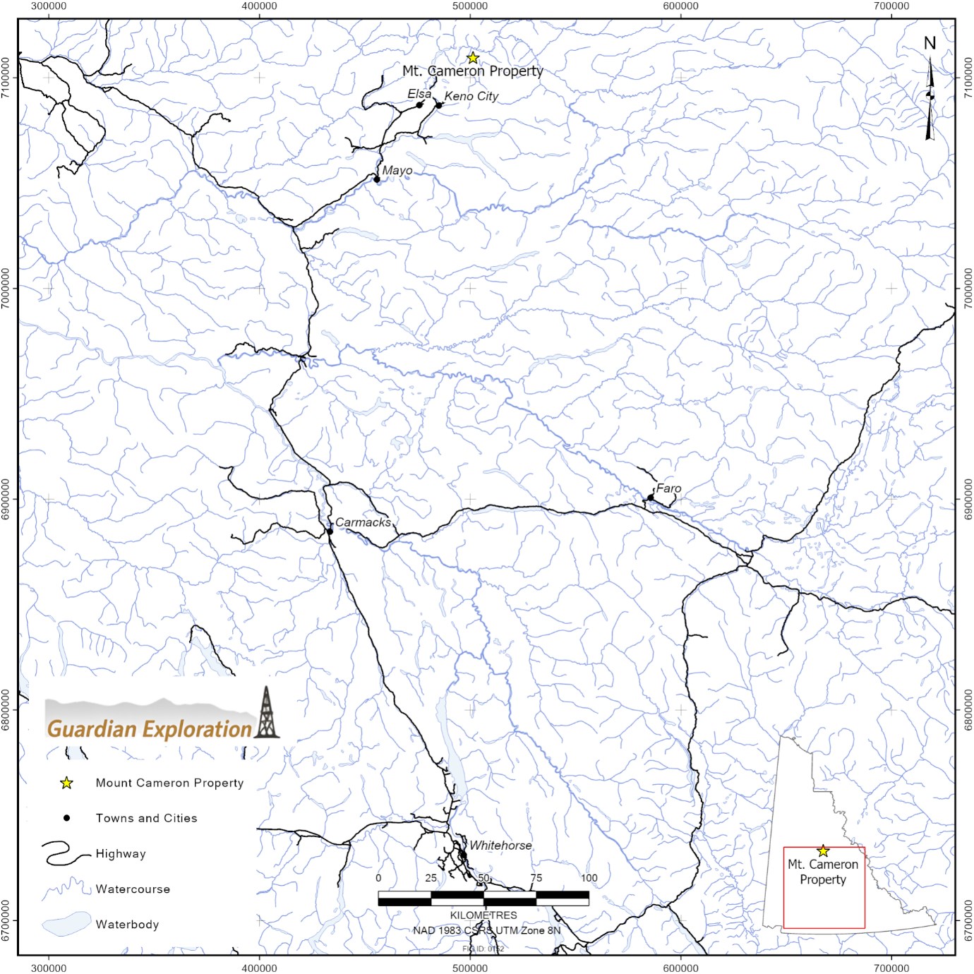
Figure 1: Mount Cameron Property Location, Yukon, Canada
To view an enhanced version of this graphic, please visit:
https://images.newsfilecorp.com/files/5066/305397_f95fc974e45b0871_002full.jpg
The Company expects to receive final processed geophysical products and interpretations in the coming weeks.
Mount Cameron hosts numerous historical high-grade silver, lead and zinc occurrences and remains significantly underexplored by modern exploration methods. Guardian believes the combination of advanced airborne geophysics, detailed geological mapping and systematic exploration provides an excellent opportunity to identify additional high-priority exploration targets across the property.
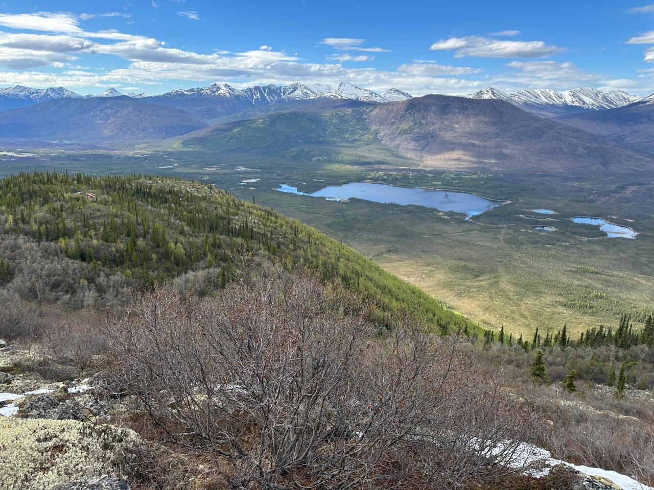
Figure 2: Image of the Mount Cameron Ag-Pb-Zn Project, Yukon, Canada (June 2026)
To view an enhanced version of this graphic, please visit:
https://images.newsfilecorp.com/files/5066/305397_f95fc974e45b0871_003full.jpg
About the Mount Cameron Project
The Mount Cameron Ag-Pb-Zn Project is an exploration-stage polymetallic project containing several historical high-grade mineral occurrences. It is located within Yukon's Mayo Mining District and comprises 154 Yukon quartz mining claims covering approximately 3,017 hectares.
Yukon MINFILE and historical assessment reports describe the Project as hosting both structurally controlled silver-lead-zinc vein mineralization and carbonate replacement deposit ("CRD")-style mineralization along the eastern margin of the prolific Keno Hill Silver District.
The Project encompasses two significant historical mineral occurrences documented in the Yukon MINFILE database:
- Clark (MINFILE 106D 011) - classified by Yukon MINFILE as a Deposit, consisting of CRD-style Ag-Pb-Zn mineralization; and
- Cameron (MINFILE 106D 012) - classified by Yukon MINFILE as a Prospect, comprising a structurally controlled Ag-Pb-Zn vein and replacement system.
Data Compilation and Digitization
Guardian's geological team has compiled and digitized historical exploration, surface and underground drilling, and analytical data from available assessment reports for the Clark and Cameron occurrences using Leapfrog 3D modelling software. Preliminary compilation completed to date includes 104 drill holes, several trenches, and considers historic reported geological observations and interpretations. Investigation and confirmation of these historic results is one of the objectives of the 2026 surface exploration program and planned twinning of historic drill holes.
Clark Occurrence: Selected Intersections*
| Section | Hole | From | To | Length | Ag | Pb | Zn |
| (ft) (m) | (oz/ ton) (g/t) | (%) | (%) | ||||
| 175E | H-12 | 0 | 8 | 8 (2.4) | 5.58 (191.3) | 5.85 | 10.56 |
| 190E | Trench | 31 (9.4) | 10.68 (366.2) | 9.4 | 4.6 | ||
| 190E | W-1 | 0 | 45 | 45 (13.7) | 4 (137.1) | 6 | 7.08 |
| 304E | H-6 | 0 | 27 | 27 (8.2) | 6.49 (222.5) | 5 | 3.93 |
| 300E | Trench | 0 | 13 | 13 (4.0) | 15.7 (538.3) | 15.5 | 6.4 |
| 310E | W-9 | 42 | 56.5 | 14.5 (4.4) | 11.5 (394.3) | 9.14 | 6.69 |
| 325E | H-17 | 34 | 79 | 45 (13.7) | 3.52 (120.7) | 3.31 | 7.26 |
| 352E | H-21 | 23 | 41 | 18 (5.5) | 6.77 (232.1) | 6.5 | 6.3 |
Source: Assessment Report 014774; Bullion Mountain Mining Ltd.; 26 Feb 1975
*Historical exploration results were reported by previous operators, including Bullion Mountain Mining Ltd. and Scurry-Rainbow Oil Ltd., and have not been independently verified. Reported lengths are drill-intersected or trench lengths and do not represent true widths, which are unknown. The From-To interval for the 190E trench was not reported in the source. Metric equivalents shown in parentheses are converted at 1 ft = 0.3048 m and 1 oz/ton (troy ounces per short ton) = 34.286 g/t.
Intersections were selected to illustrate the tenor of the better-mineralized portions of the Clark occurrence, as reported in AR 014774, and are not necessarily representative of mineralization throughout the occurrence; lower-grade and unmineralized intervals are present in the historical dataset.
Historic core stacked at the Clark occurrence will be examined, relogged, and resampled, subject to confirmation that the core is sufficiently intact and complete.
Further information regarding the Mount Cameron Project is available on the Company's website.
The Company expects to provide additional updates throughout the exploration season, including progress on field activities, commencement of diamond drilling, and assay results as they become available.
Ken Reading Canadian Prospector and Geologist
The Company also wishes to acknowledge the passing of legendary Canadian prospector and geologist Kenneth ("Ken") Reading (October 1929 – July 2026), whose remarkable career in mineral exploration spanned more than 80 years. A renowned Canadian prospector and geologist, Ken began his career in the 1940s and spent decades exploring some of Canada's most prospective mineral districts, including multiple field seasons in Nunavut. Throughout his distinguished career, he was credited with numerous significant mineral discoveries, including the Sundog Gold Project, and contributed to the geological understanding of several important Canadian mineral camps. Ken's connection to Sundog alone spanned nearly four decades, beginning with his first visits to the property in the mid-1980s. His exceptional geological insight, unwavering curiosity, and lifelong passion for mineral exploration left an enduring legacy within the Canadian mining industry. Beyond his remarkable discoveries, Ken will be remembered for his generosity in sharing knowledge, mentoring fellow geologists, and inspiring generations of explorers.
Graydon Kowal, President & Chief Executive Officer of Guardian Exploration, commented: "Ken Reading was one of the finest geologists I have ever known. Those of us fortunate enough to know him will remember not only his remarkable discoveries, but also his thoughtful typewritten letters—carefully crafted and filled with geological insight, encouragement, and wisdom gathered over decades in the field. In an era of emails and text messages, Ken's personal correspondence reflected the same patience, precision, and integrity that defined his work as a geologist. His passing is a tremendous loss to our industry, but his legacy will live on through the countless geologists and explorers he inspired."
Commitment to First Nations and Local Communities
Guardian acknowledges that the Mount Cameron Project lies within the Traditional Territory of the First Nation of Na-Cho Nyäk Dun ("FNNND"). The Company is committed to building a respectful, long-term relationship with the FNNND and the Mayo community through collaboration, transparency and shared benefits.
Guardian will prioritize local employment and training opportunities, support procurement from Indigenous-owned businesses wherever practical, and maintain high standards of environmental stewardship throughout its exploration activities. The Company is committed to maintaining open and ongoing dialogue with the FNNND and local stakeholders as work advances.
Qualified Person
The scientific and technical information contained in this news release has been reviewed and approved by Steven Dudka, BSc., P.Geo., EGBC #21326, a consulting geologist to the Company who is a "Qualified Person" as such term is defined under National Instrument 43-101 - Standards of Disclosure for Mineral Projects ("NI 43-101"). The Qualified Person has been unable to verify the historical exploration information, including drill results, reported in this news release. Although the Company considers these results relevant for exploration targeting, they should not be relied upon and are not necessarily indicative of future exploration results.
Neither the TSX Venture Exchange nor its Regulation Services Provider (as that term is defined in the policies of the TSX Venture Exchange) accepts responsibility for the adequacy or accuracy of this release.
On Behalf of the Board of Guardian Exploration Inc.
"Graydon Kowal"
Graydon Kowal
President & Chief Executive Officer
FOR FURTHER INFORMATION PLEASE CONTACT:
Graydon Kowal
President & Chief Executive Officer
Tel: (403) 730-6333
Email: gkowal@guardianex.com
CAUTIONARY STATEMENT REGARDING FORWARD-LOOKING INFORMATION:
This news release includes certain "forward-looking statements" within the meaning of applicable Canadian securities legislation. Such statements are based on management's expectations as of the date hereof. Forward-looking statements include, but are not limited to, statements regarding planned or future exploration activities, potential follow-up programs, the advancement of exploration targets, potential drilling programs, future permitting, and the Company's strategic objectives and priorities.
Forward-looking statements are necessarily based upon a number of estimates and assumptions that, while considered reasonable at the time they are made, are subject to known and unknown risks, uncertainties, and other factors that may cause actual results or future events to differ materially from those expressed or implied by such forward-looking statements. These risks and uncertainties include, but are not limited to, exploration and development risks, results of exploration activities, availability of financing, receipt of regulatory and stock exchange approvals, permitting timelines, environmental and Indigenous consultation processes, operational and logistical challenges, commodity price fluctuations, and general economic and market conditions.
There can be no assurance that forward-looking statements will prove to be accurate, as actual results and future events could differ materially from those anticipated. Accordingly, readers should not place undue reliance on forward-looking statements. Guardian Exploration Inc. disclaims any intention or obligation to update or revise any forward-looking statements, whether as a result of new information, future events, or otherwise, except as required by applicable law.
###

To view the source version of this press release, please visit https://www.newsfilecorp.com/release/305397